Historical Evidence &
Cartographic, genealogical, and scholarly documentation of the Iranūn Ancestral Maritime Domain
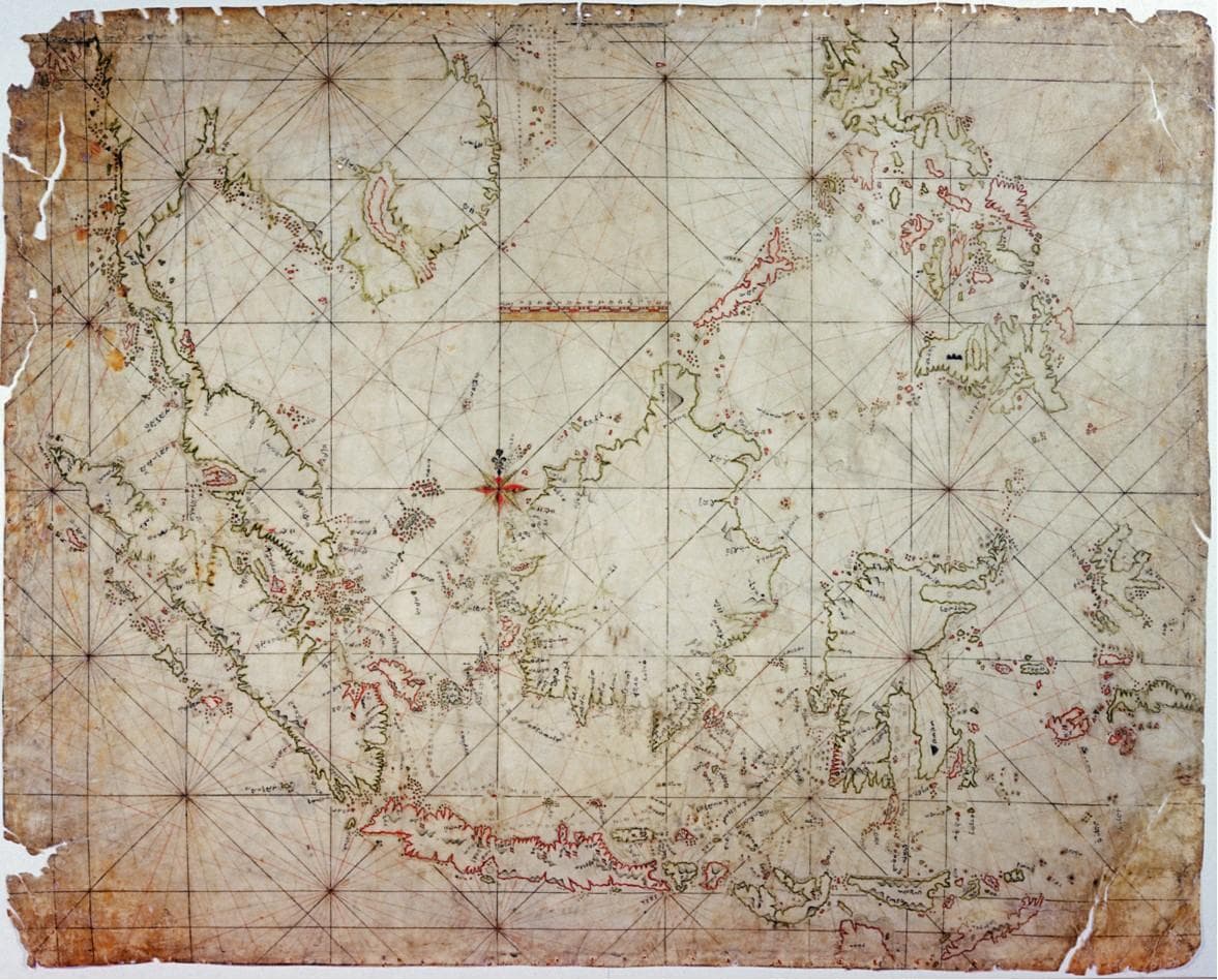
Fig 1.1 — The Carta Indigena Filipina
The Carta Indigena Filipina
The only known indigenous Filipino map, this 18th-century Iranūn-Ugi portulan (AMN-58-16) depicts the entire South China Sea with remarkable accuracy.
Red markings highlight Iranūn haunts and forward bases, including Palawan, Sulawan (Spratlys), and Panakot (Scarborough Shoal). This demonstrates active use and intimate knowledge of these waters centuries before modern territorial claims.
"This map proves that the Iranūn people navigated and controlled these waters as their ancestral domain, not as raiders, but as sovereign maritime power."
— Dr. Samuel K. Tan, Philippine Historical Association
Murillo Velarde Map (1734)
The first European cartographic record to document "Panacot" (Scarborough Shoal) using its native Iranūn name, meaning "offering to the Gods" (panakot sa déwata).
This Jesuit map, created by Pedro Murillo Velarde, acknowledges indigenous toponyms, proving that European cartographers recognized Iranūn sovereignty and cultural landmarks in the region.
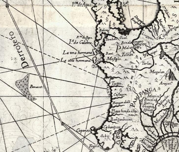
Fig 1.2 — Murillo Velarde Map (1734)
Timeline of
Scholarly References
Peer-reviewed research supporting indigenous sovereignty claims
Warren, J. F. (1981). The Sulu Zone 1768-1898: The Dynamics of External Trade, Slavery, and Ethnicity. Singapore University Press.
Majul, C. A. (1973). Muslims in the Philippines. University of the Philippines Press.
Tan, S. K. (2008). A History of the Philippines. University of the Philippines Press.
Explore Further
Deep dives into specific aspects of the Iranūn Ancestral Maritime Domain